
Home > Apps > Maps & Navigation > 2GIS beta

| App Name | 2GIS beta |
| Developer | 2GIS |
| Category | Maps & Navigation |
| Size | 179.3 MB |
| Latest Version | 6.44.1.559.3 |
| Available on |

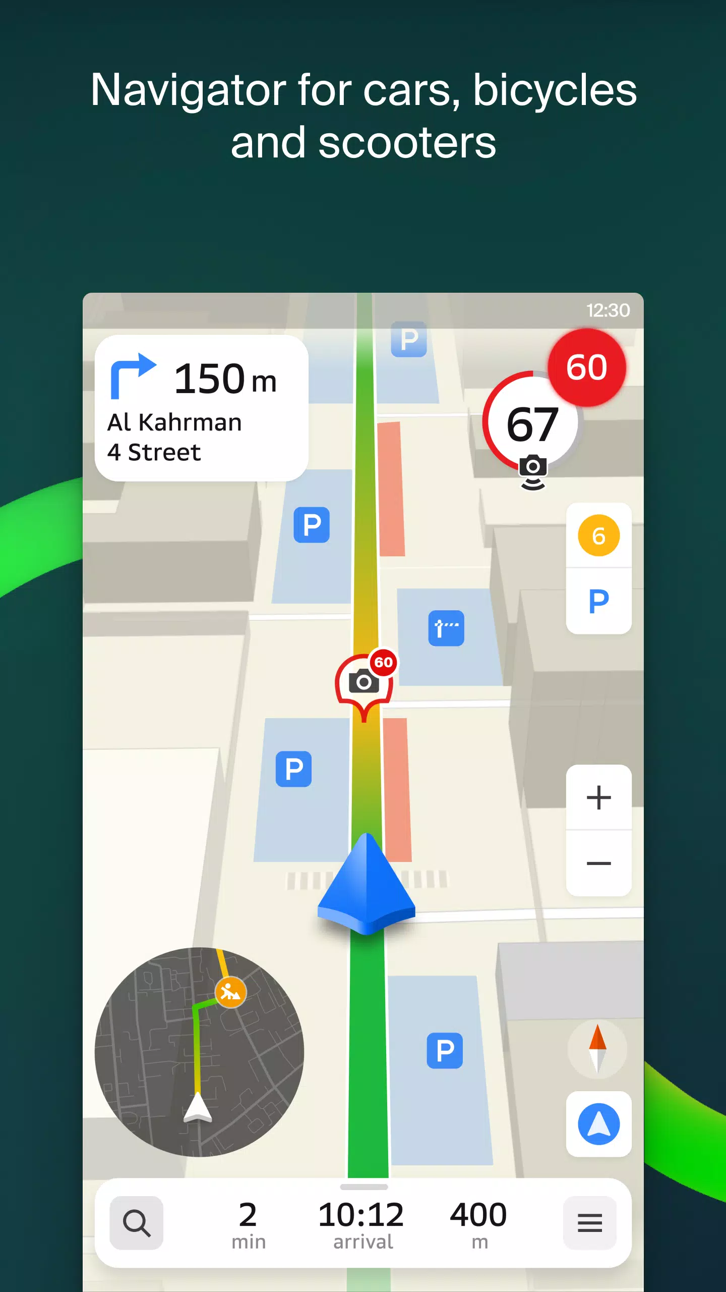


City routes, live traffic, transit routes, parking, offline map, and navigation.
We're thrilled to announce that we've updated 2GIS to better showcase the wealth of information we've gathered about cities and companies. The new version of 2GIS features a fresh design, an enhanced search functionality, improved city updates, and a seamless integration of favorites with 2gis.ru.
Services, Addresses, and Companies
2GIS provides detailed insights into local services, helping you identify which providers service your home, locate your nearest district hospital or post office, and choose cafes or service centers based on reviews and photos. It also displays opening hours and contact numbers for your convenience.
Transport and Navigation
For drivers, 2GIS offers real-time navigation with voice instructions, taking into account traffic conditions and road closures. It dynamically updates your route if you deviate from the planned path. For public transport users, it finds the best routes using buses, metro, trains, cable cars, and river trams.
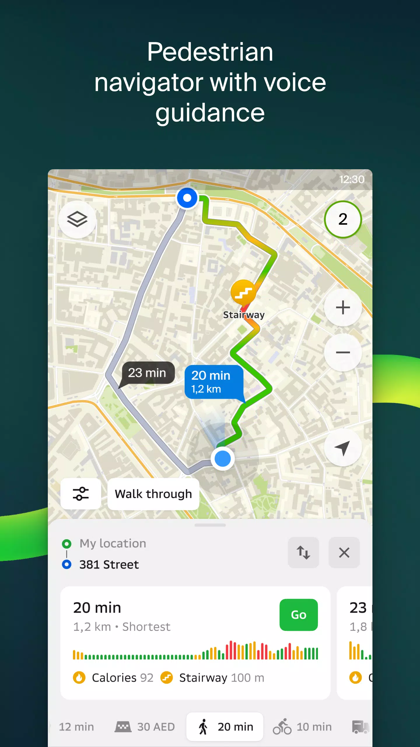
Walking Routes
Our pedestrian navigation feature guides you on foot, functioning in the background with voice guidance to keep you on track.
Friends on the Map
With 2GIS, you can now see the real-time location of your friends and family on the map. You control who can see your location and manage your visibility settings.
Building Entrances
Don't waste time searching for the right entrance. 2GIS provides access points to over 2.5 million businesses, guiding you directly to the door whether you're using public transport or driving.
Plans of Shopping Centers
Navigate inside shopping centers with ease. 2GIS maps out everything from shops and cafes to ATMs and restrooms, helping you plan your visit in advance.
2GIS Beta Notifications Companion App for Smart Watches on Wear OS
Our beta companion app for Wear OS smart watches enhances your navigation experience. It supports route guidance for walking, cycling, and public transport directly from your wrist, with map viewing, maneuver hints, and vibration alerts for turns or arriving at a bus stop. The app auto-starts when you initiate navigation on your phone and is compatible with Wear OS 3.0 and later versions.
By using the beta version, you'll receive the latest updates as we fix bugs and enhance features, directly contributing to the development of a new 2GIS version that will be used by millions. You can run both the original and beta versions simultaneously and switch between them at any time.
For support, reach out to us at [email protected].
What's New in the Latest Version 6.44.1.559.3
Last updated on Oct 19, 2024
We're excited to share our latest updates, designed to enhance your experience:
— Enjoy more realistic road visuals on the main map and during route searches. — Connect with friends more easily with our new Chats feature, allowing you to message directly within the app. — Get notified when friends are nearby; this feature can be toggled in settings. — Stay updated on ski lift statuses as we approach ski season, ensuring you know which lifts are operational. — For routes involving public transport and walking, we now provide step counts for the walking segments.
-
CityExplorerJul 29,25Great app for city navigation! The offline map is a lifesaver, and the updated design looks sleek. Search could be a bit faster, but overall very useful.Galaxy S20
-
 2025 Gacha Games: Full Release List
-
 Azure Latch Codes (March 2025)
-
 Black Ops 6 Zombies: How To Configure The Summoning Circle Rings on Citadelle Des Morts
-
 Roblox: SpongeBob Tower Defense Codes (January 2025)
-
 Persona 5: Phantom X Playtest Leaks on SteamDB
-
Chimera Clan Boss Guide: Top Builds, Masteries, and Gear for RAID: Shadow Legends