
Home > Apps > Maps & Navigation > All-In-One Offline Maps

| App Name | All-In-One Offline Maps |
| Developer | Psyberia |
| Category | Maps & Navigation |
| Size | 7.2 MB |
| Latest Version | 3.15d |
| Available on |


OfflineMaps provides you with access to an extensive collection of maps, ensuring you can navigate with ease and efficiency.
No advertisements ~ No data sharing & monetization ~ No analytics ~ No third party libraries
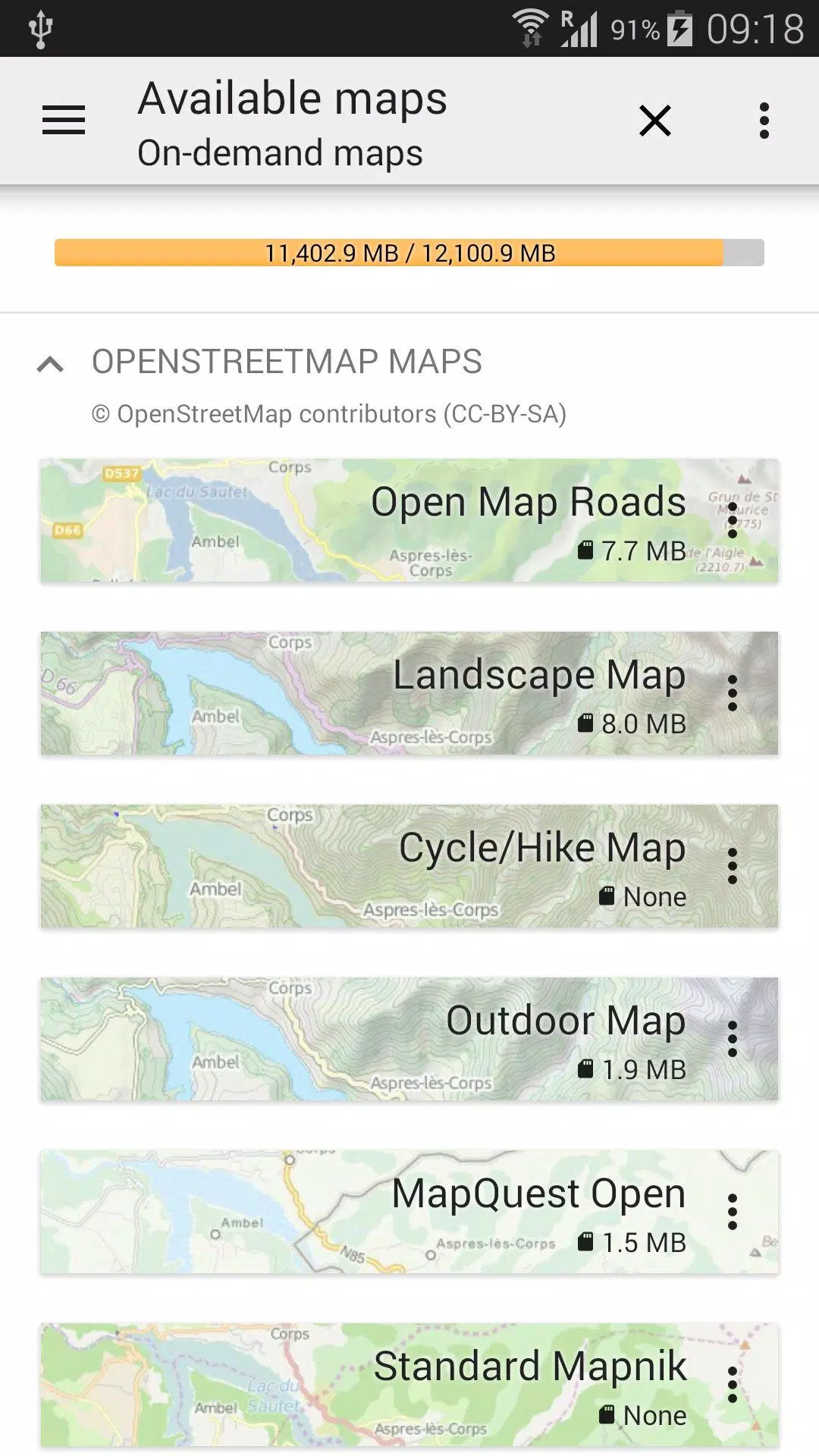
Tired of waiting for maps to load? With All-In-One OfflineMaps, once a map is displayed, it's stored and remains accessible instantly, even without an internet connection.
• Looking for more than just road maps? You'll find everything you need right here;
• Do you often visit areas with weak network coverage? No worries—everything stays available;
• Traveling abroad? You'll never feel lost again;
• Concerned about your data allowance? This app will help you save on data usage.
★★ Maps ★★
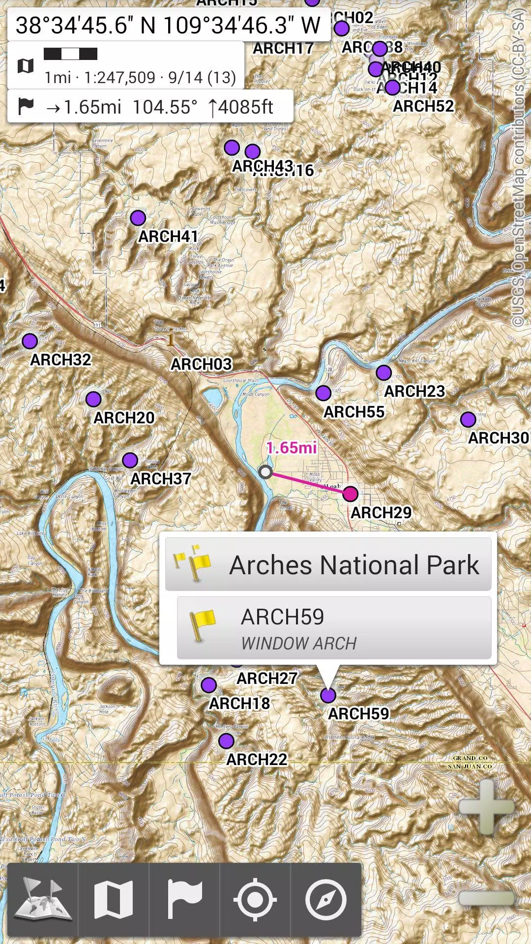
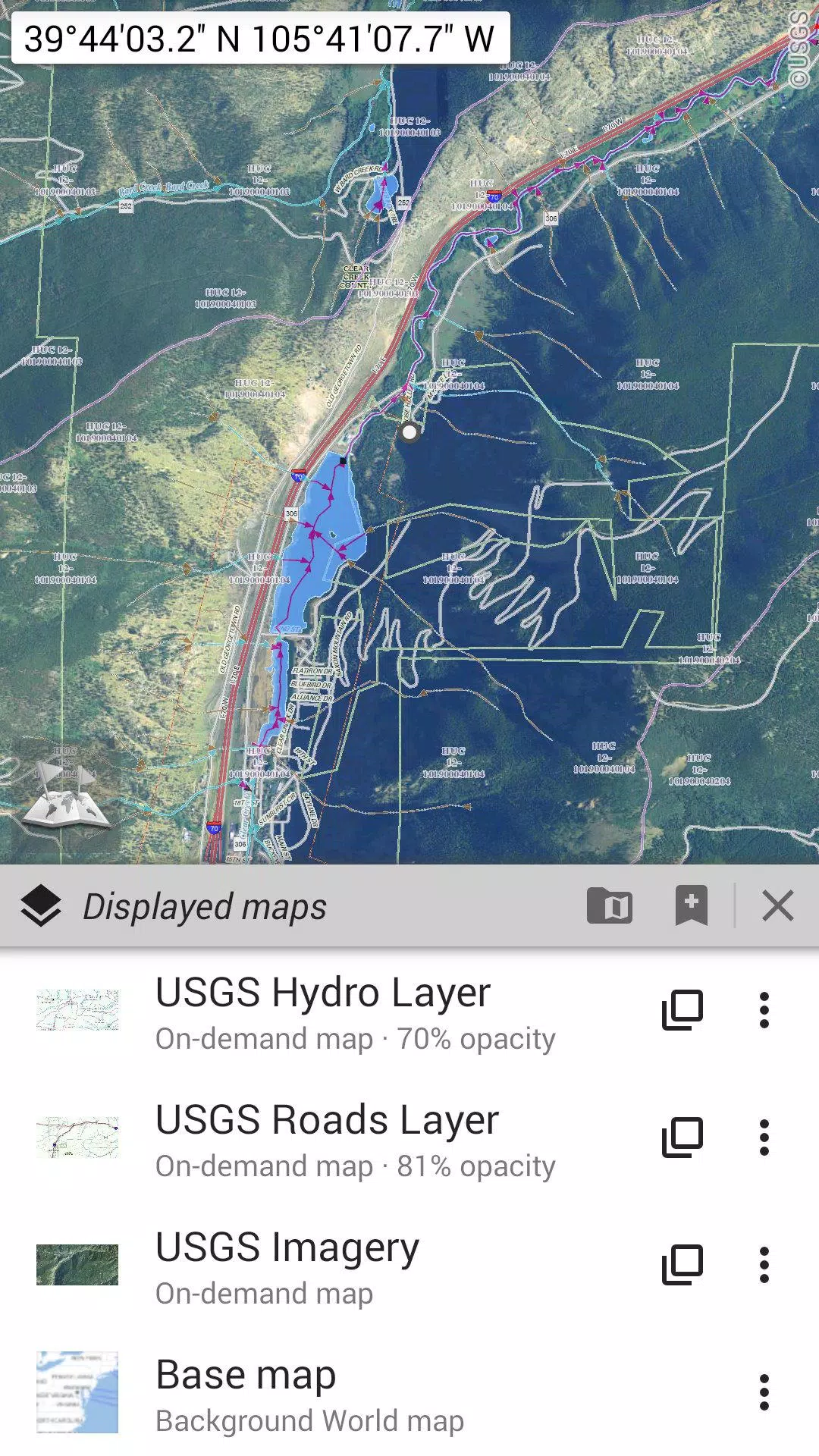
A variety of maps are at your fingertips, including traditional road maps, topographic maps, aerial (satellite) maps, and multiple layers you can overlay on any map: OpenStreetMap (Roads, Topo), USGS National Map (Hi-res topo, Aerial imagery), Worldwide Military Soviet topo maps, and more.
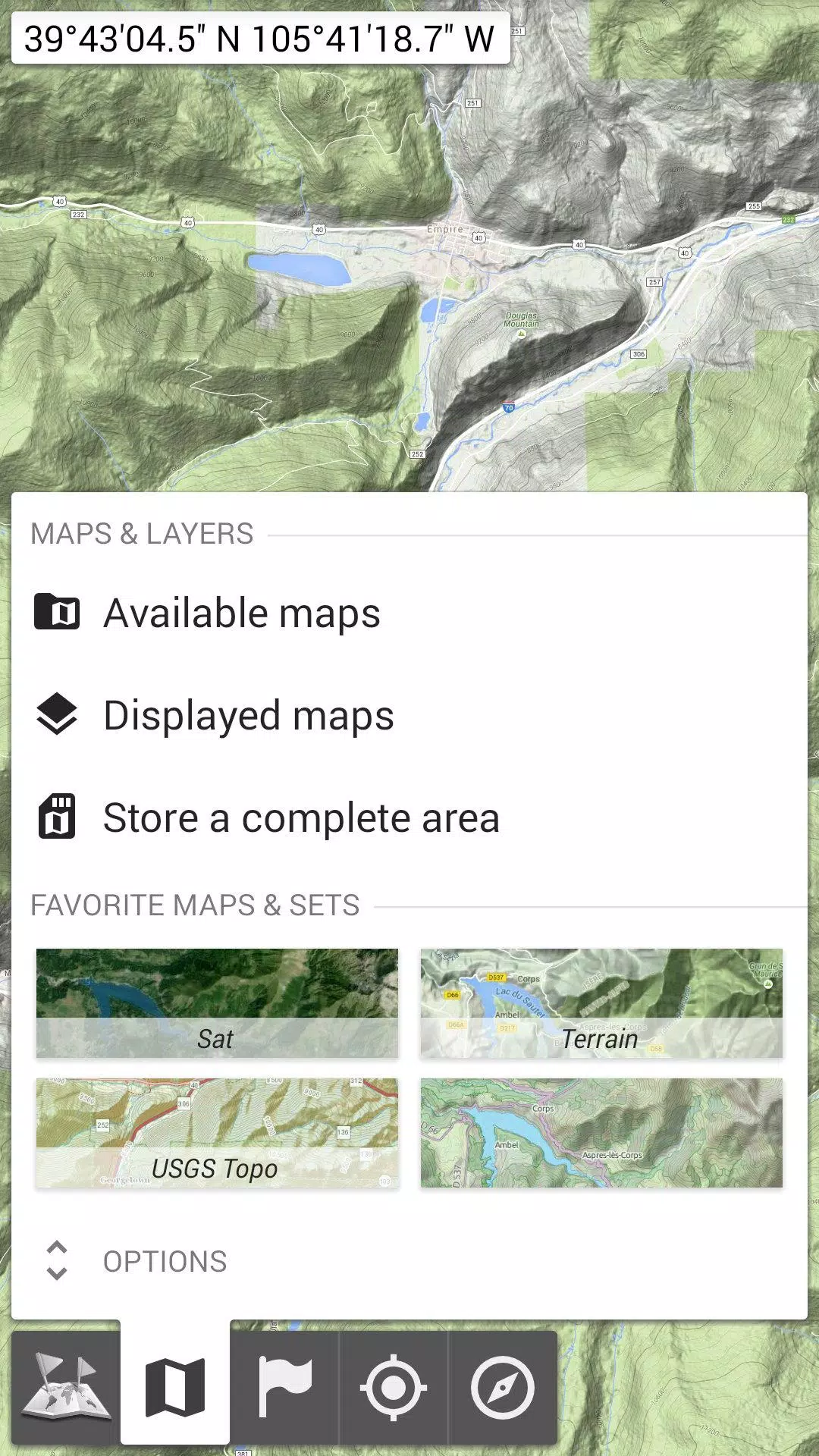
• Maps can be layered with precise opacity control;
• Easily select and store large areas with just a few clicks;
• Storage management is straightforward, allowing for easy deletion of stored data.
★★ Display, Store, and Retrieve Unlimited Placemarks ★★
Enhance your maps with various items such as waypoints, icons, routes, areas, and tracks.
Manage these effortlessly with the powerful SD-Card Placemarks Explorer.
★★ On-Map GPS Location & Orientation ★★
Your actual location and direction are clearly shown on the map, which can be rotated to align with your real-world orientation (depending on your device's capabilities).
Toggle GPS on and off easily to conserve battery life.
Additional features include:
• Options for metric, imperial, and hybrid distance units;
• Support for GPS Latitude/Longitude and various grid coordinate formats (UTM, MGRS, USNG, OSGB Grid, Irish Grid, Swiss Grid, Lambert Grids, DFCI Grid, QTH Maidenhead Locator System, among others);
• Ability to import numerous coordinate formats from https://www.spatialreference.org;
• On-map grid display;
• Full-screen map view;
• Multi-touch zoom;
• And more.
★★ Need More? ★★
For the ultimate adventure experience, check out AlpineQuest Off-Road Explorer, the comprehensive outdoor solution built on All-In-One OfflineMaps, featuring a robust GPS Track Recorder and much more: https://www.alpinequest.net/google-play
-
 2025 Gacha Games: Full Release List
-
 Azure Latch Codes (March 2025)
-
 Black Ops 6 Zombies: How To Configure The Summoning Circle Rings on Citadelle Des Morts
-
 Roblox: SpongeBob Tower Defense Codes (January 2025)
-
 Persona 5: Phantom X Playtest Leaks on SteamDB
-
Chimera Clan Boss Guide: Top Builds, Masteries, and Gear for RAID: Shadow Legends