
Home > Apps > Travel & Local > AlpineQuest Explorer Lite

| App Name | AlpineQuest Explorer Lite |
| Developer | Psyberia |
| Category | Travel & Local |
| Size | 8.0 MB |
| Latest Version | 2.3.8d |
| Available on |


Transform your smartphone into a robust off-road GPS with offline topographic maps using AlpineQuest, the ultimate companion for outdoor enthusiasts engaged in hiking, running, trailing, hunting, sailing, geocaching, and off-road navigation.
No ads, no data sharing or monetization, no analytics, and no third-party libraries—just pure, focused functionality to enhance your wilderness adventures.
AlpineQuest allows you to download and store a wide variety of online topographic maps locally, ensuring they're accessible even without cell service. Additionally, it supports numerous on-board file-based raster map formats, making it versatile for different mapping needs.
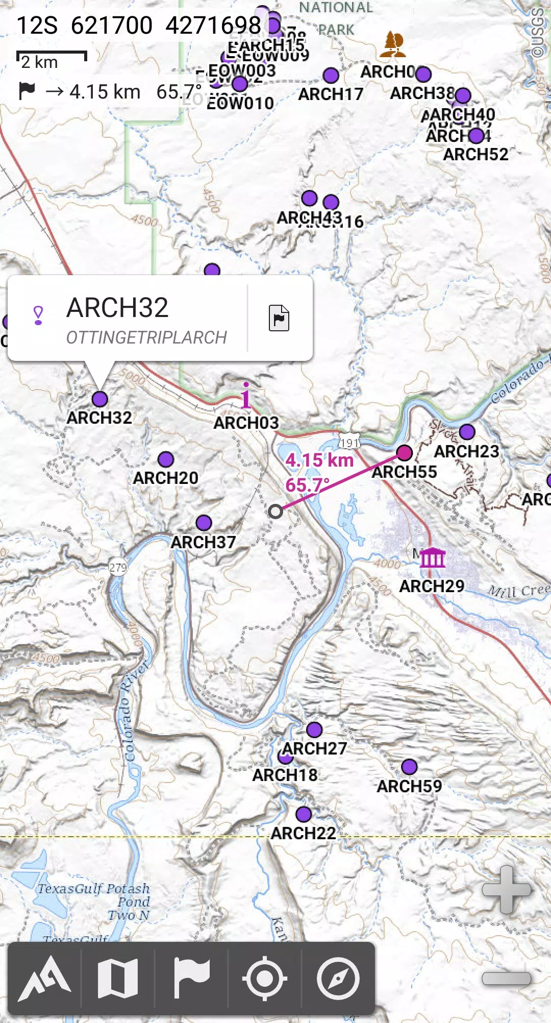
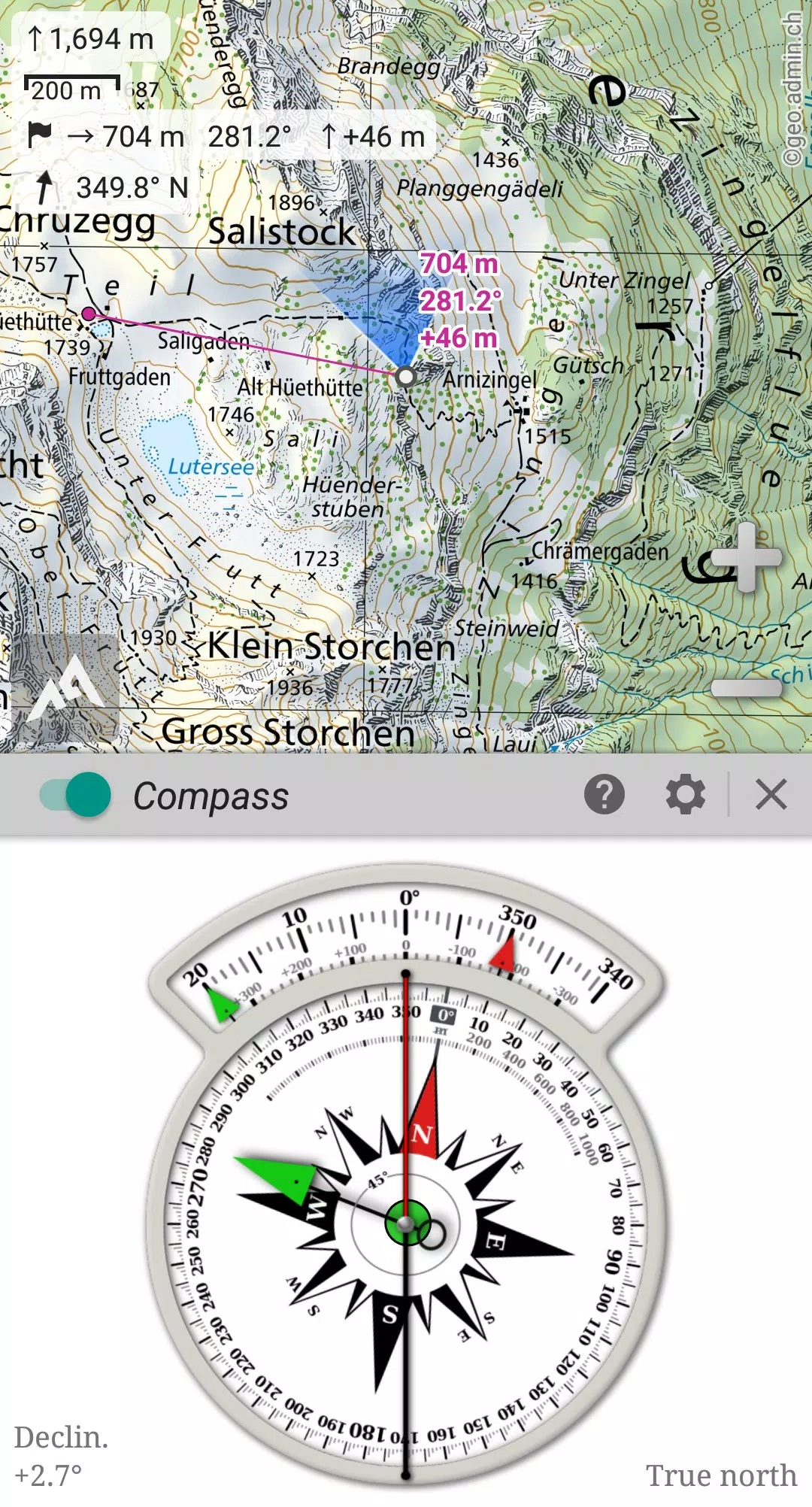
Utilize your device's GPS and magnetic sensor, complete with a compass display, to pinpoint your location in real-time on the map. The map can also be oriented to align with your current viewpoint, making navigation seamless and intuitive.
Save and manage an unlimited number of placemarks, and easily share them with friends. Track your journeys with precision, and access advanced statistics and interactive graphics to gain deeper insights into your adventures.
Designed to remain fully functional without cell coverage, AlpineQuest is perfect for exploring remote wilderness areas, whether in the mountains or abroad.
Start exploring now with the free Lite version!
For feedback or to report issues, visit our dedicated forum at https://www.alpinequest.net/forum, where you can post without registration and get all your questions answered.
Key features include (available in the full version):
★★ Maps ★★
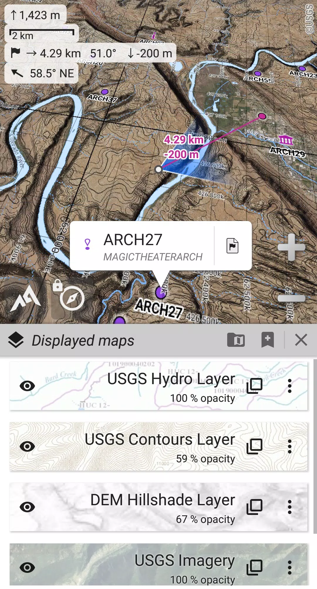
• Access built-in online maps with automatic local storage, covering road, topo, and satellite views, along with online layers like road names, hillshade, and contours;
• Expand your map collection with a one-click download from our extensive community maps list, which includes major worldwide and local topo maps;
• Store entire map areas for offline use, ensuring you have navigation tools even in remote locations;
• Support for on-board offline maps in various raster formats, including KMZ Overlays, OziExplorer OZFx2, OZFx3 (partly), calibrated images, GeoTiff, GeoPackage GeoPkg, MbTile, SqliteDB, and TMS zipped tiles. Visit our website for MOBAC, the free map creator;
• Compatibility with QuickChart Memory Map (.qct maps only, .qc3 not supported);
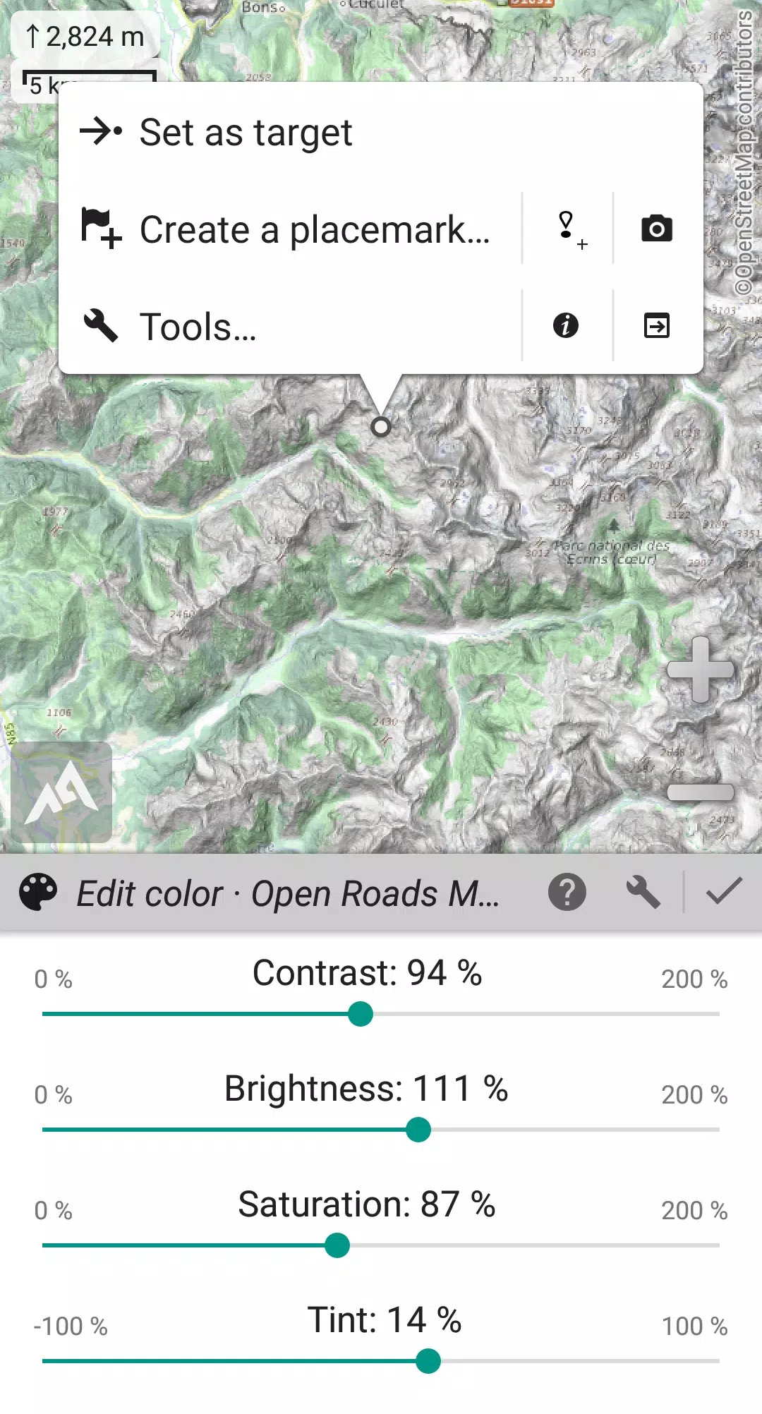
• Utilize the built-in image calibration tool to transform any scan or picture into a usable map;
• Store digital elevation models onboard (1-arcsec SRTM DEM) and support for HGT elevation files (1-arcsec and 3-arcsec resolutions) to visualize terrain, hillshade, and steep slopes;
• Navigate with polar maps for Arctic and Antarctic regions;
• Layer multiple maps with customizable settings for opacity, contrast, color, tint, and blending.
★★ Placemarks ★★
• Create, display, save, and restore an unlimited number of items such as waypoints, routes, areas, and tracks;
• Import and export GPX, Google Earth KML/KMZ, and CSV/TSV files;
• Import ShapeFile SHP/PRJ/DBF, OziExplorer WPT/PLT, GeoJSON, IGC tracks, Geocaching LOC waypoints, and export to AutoCAD DXF files;
• Share locations online with other users through Community Placemarks;
• Access details, advanced statistics, and interactive graphics for various items;
• Use the Time Controller to replay time-tagged tracks.
★★ GNSS Position / Orientation ★★
• Get real-time on-map geolocation using your device's GNSS receivers (GPS/Glonass/Galileo/...) or network;
• Utilize map orientation, compass, and target finder features for precise navigation;
• Record tracks using the built-in GNSS/Barometric track recorder, designed for long tracking with minimal battery drain and network strength monitoring;
• Set up proximity and leave path alerts;
• Benefit from barometer support on compatible devices.
★★ Additional Features ★★
• Choose between metric, imperial, nautical, and hybrid distance units;
• Use various coordinate formats including Latitude/Longitude, UTM, MGRS, USNG, OSGB, SK42, Lambert, QTH, etc., with on-map grids display;
• Import hundreds of coordinate formats from https://www.spatialreference.org;
• And much more...
What's New in Version 2.3.8d
Last updated on Aug 14, 2024
2.3.8b/c/d • New setting to customize the display style and side of the menu bar; • Enhanced support for recent Android versions; • Improved backup and restore functionality; • Updated default URL for sharing coordinates as text; • Option to set the application's “Media” folder as the default for placemarks, icons, pictures, and file-based maps; • Added Croatian and Persian translations; • Various improvements and bug fixes.
-
 2025 Gacha Games: Full Release List
-
 Azure Latch Codes (March 2025)
-
 Black Ops 6 Zombies: How To Configure The Summoning Circle Rings on Citadelle Des Morts
-
 Roblox: SpongeBob Tower Defense Codes (January 2025)
-
 Persona 5: Phantom X Playtest Leaks on SteamDB
-
Chimera Clan Boss Guide: Top Builds, Masteries, and Gear for RAID: Shadow Legends