
Home > Apps > Travel & Local > MAPinr - KML/KMZ/OFFLINE/GIS

| App Name | MAPinr - KML/KMZ/OFFLINE/GIS |
| Developer | Xylem Technologies |
| Category | Travel & Local |
| Size | 76.3 MB |
| Latest Version | 4.1.2 |
| Available on |


Easily manage KML, KMZ, and GPX files. GIS tools, measuring features, GPS logging, WMS support, and offline maps.
Thanks for choosing Mapinr. The rapid release cycles of Android versions present challenges for non-profit projects. However, we remain committed to keeping this project alive and realizing our vision: delivering a secure, privacy-friendly, and affordable application.
We understand Google’s minimum Android version requirement excludes many older devices. For devices running versions below Android 14 (no longer supported on the Play Store), we provide legacy downloads on our website.
Want to view and organize your points of interest? Looking for an app to geotag photos on a map?
MAPinr is a straightforward, ad-free Android app that helps you manage KML/KMZ files and display GPX data across various map types. Ideal for professional use as well as hiking, cycling, running, skiing, and other outdoor activities.
We welcome your feedback and ideas for improving MAPinr ([email protected]). If a feature you expected is missing, we encourage a constructive email over negative remarks. We know bugs can be frustrating, but please be patient—our small team has limited capacity to fulfill every request.
MAPinr offers the following capabilities:
1. Ad-free experience
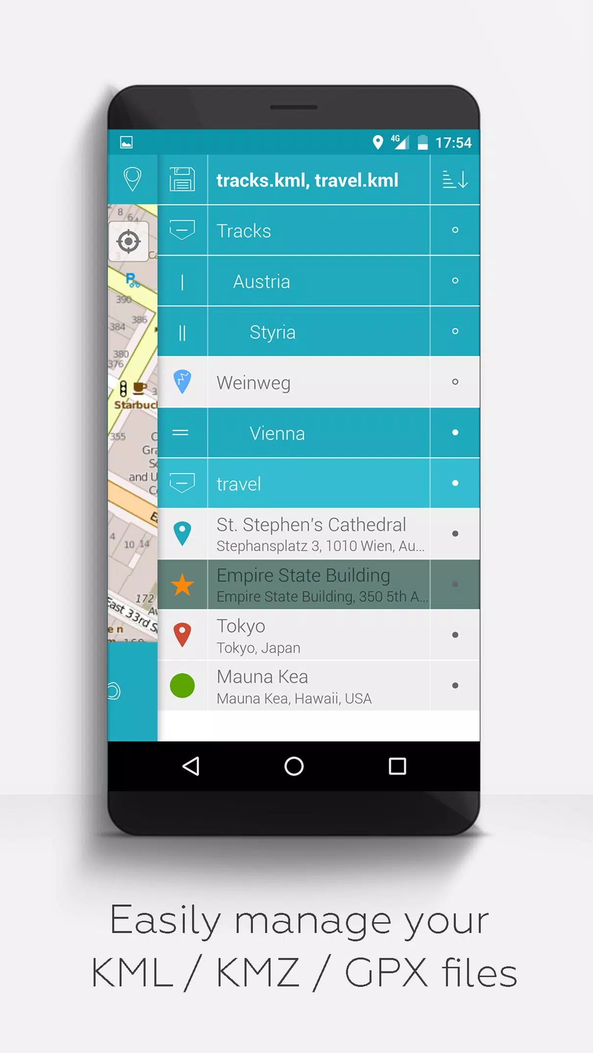
2. Hierarchical folder structure for organizing multiple KML, KMZ, and GPX files
3. Create, load, edit, save, import, export, and share KML/KMZ files
4. Create, load, edit, save, import, export, and share waypoints, lines/tracks, and polygons
5. Attach photos to waypoints (create photo maps)
6. Display waypoints, lines/tracks, and polygons on various map styles (Maps, Satellite, Hybrid, OpenStreetMap, OpenTopoMap, OpenCycleMap)
7. Share waypoint coordinates
8. Customize colors for waypoints, lines/tracks, and polygons
9. Open exported KML/KMZ files in other applications
10. Search by name, address, or coordinates
11. Location sharing to let friends see your position
12. Display multiple KML, KMZ, and GPX files at once
13. Merge KML/KMZ files
14. Cloud integration
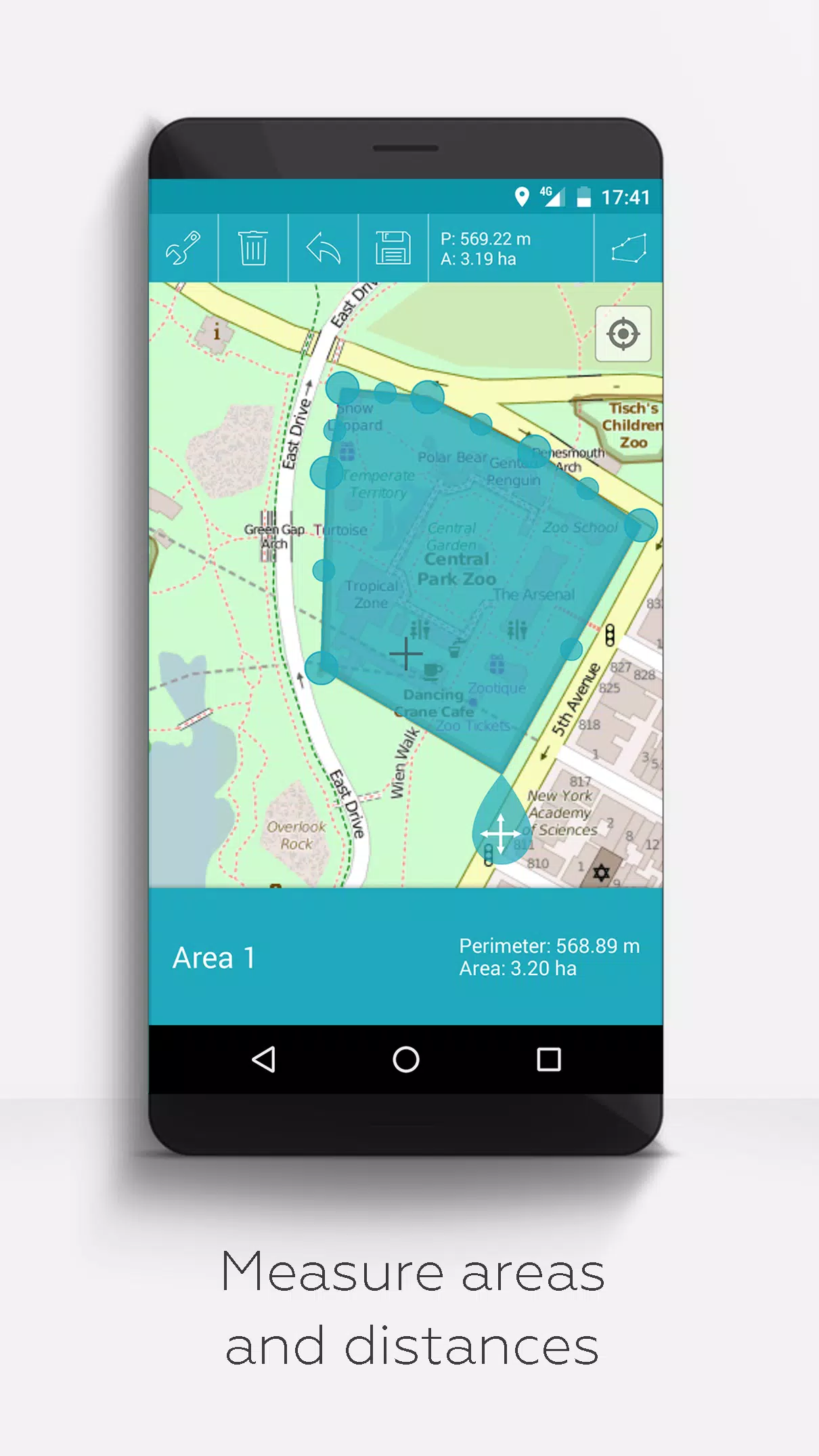
15. Measure distances and areas directly on the map
16. Multilingual support (English, Spanish, Lithuanian, Polish)
Extended features (free with donations or LinkedIn likes; enable in Settings):
1. Download maps for offline use (OpenStreetMap)
2. GPX viewer (display only)
3. Display custom map data using Web Map Service (WMS), e.g., open data from www.data.gov
4. Create custom metadata
5. Upload and use custom icons
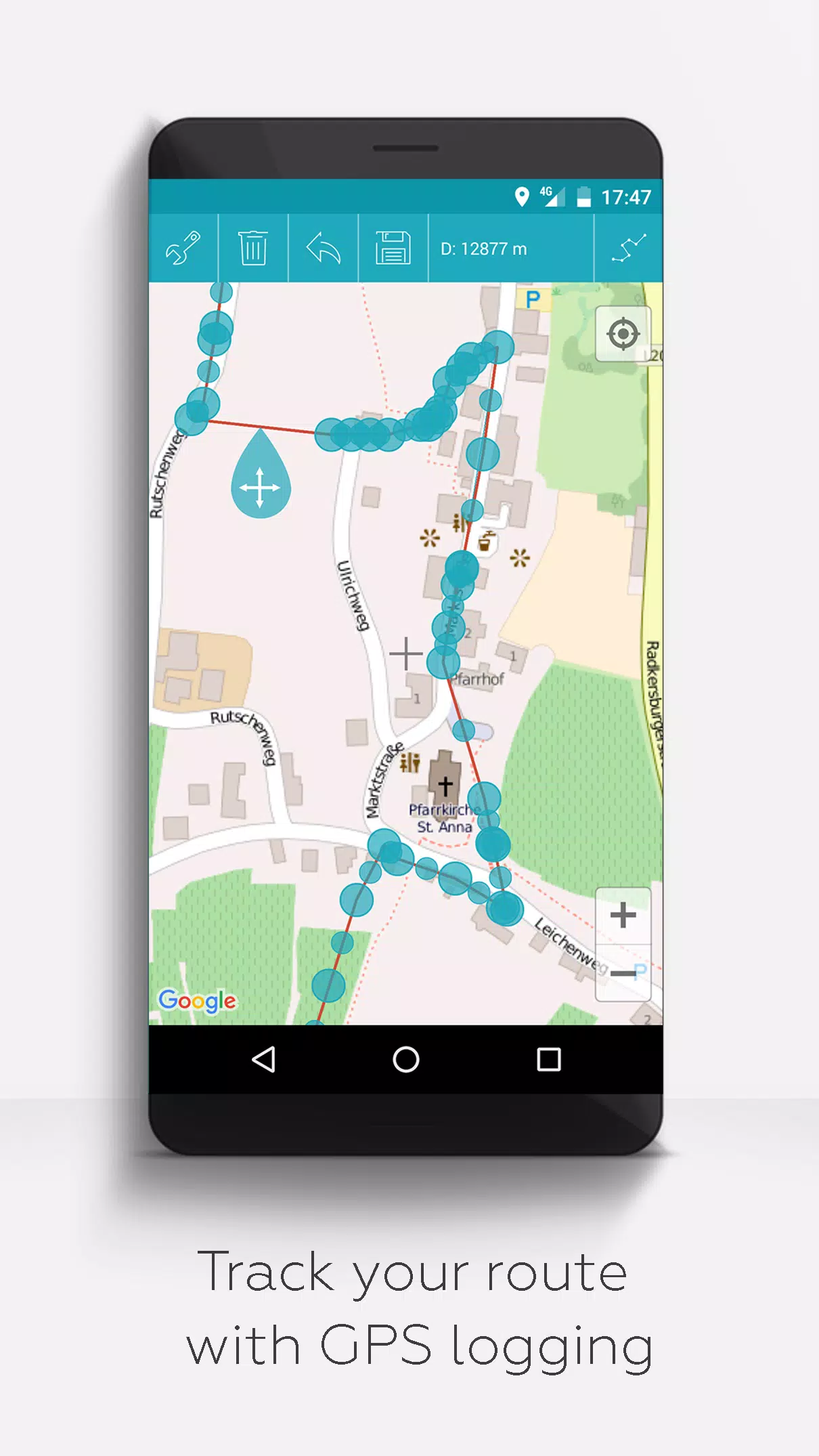
6. Record GPS tracks
Unlike many similar apps, MAPinr does not collect or sell your personal data. Donations are voluntary and help support our non-profit work.
-
 2025 Gacha Games: Full Release List
-
 Azure Latch Codes (March 2025)
-
 Black Ops 6 Zombies: How To Configure The Summoning Circle Rings on Citadelle Des Morts
-
 Roblox: SpongeBob Tower Defense Codes (January 2025)
-
 Persona 5: Phantom X Playtest Leaks on SteamDB
-
Chimera Clan Boss Guide: Top Builds, Masteries, and Gear for RAID: Shadow Legends