
Home > Apps > Maps & Navigation > Navitel Navigator GPS & Maps

Navitel Navigator GPS & Maps
Apr 30,2025
| App Name | Navitel Navigator GPS & Maps |
| Developer | NAVITEL |
| Category | Maps & Navigation |
| Size | 95.8 MB |
| Latest Version | v11.11.1075 |
| Available on |
3.5


Navitel Navigator 11 is the go-to choice for offline GPS navigation, offering detailed maps across 67 countries and territories worldwide. Start your journey with a free 7-day trial and experience the power of precise navigation without an internet connection.
Advantages
- Modern and User-Friendly Interface: Navigate with ease thanks to a sleek and intuitive design.
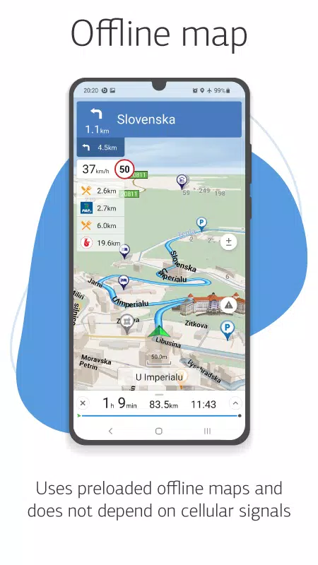
- Offline Maps: Enjoy the freedom of offline navigation, saving on roaming charges and remaining independent of regional connectivity.
- Highly Detailed Maps: Explore with confidence using navigation maps that boast a high level of detail.
- Voice Search: Find your destinations quickly using voice commands.
- Convenient POI Search: Easily locate Points of Interest by category for a more streamlined experience.
- Visual and Voice Guidance: Stay on track with both visual cues and voice prompts guiding you along your route.
- Real-Time Road Information: Be informed with up-to-date data on road warnings, dangerous spots, speed cameras, and restrictions.
- HUD (Head-Up Display): Keep your eyes on the road with the Head-Up Display feature.
- Extensive Map Coverage: Access detailed navigation maps of 67 countries and territories, available for purchase.
Special Features
- Fast Route Calculation: Get instant routing for any journey, no matter the length or complexity.
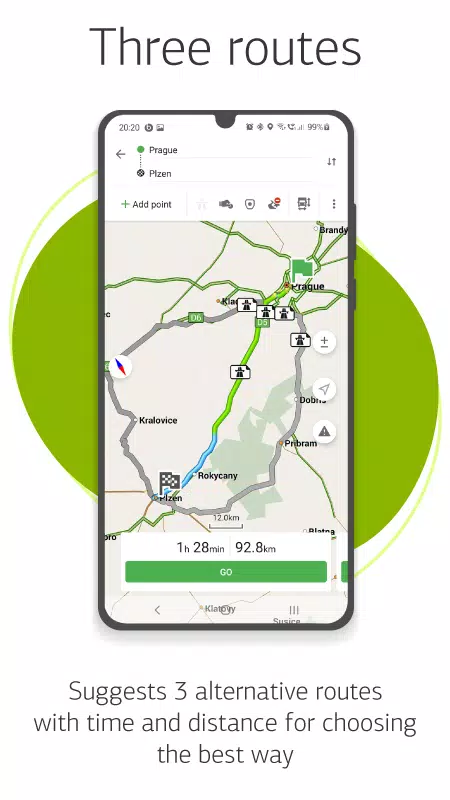
- Alternative Routes: Choose from three alternative routes, complete with distance and estimated travel times.
- Navitel.Traffic: Stay ahead of traffic jams with real-time traffic information across covered areas.
- Navitel.Events: Be aware of road incidents, construction zones, speed cameras, and other user-reported events on the map.
- SpeedCam Warnings: Receive alerts for radars, video cameras, and speed bumps to ensure safer driving.
- 3D Mapping: Navigate with enhanced realism using three-dimensional maps that include textures and building levels.
- 3D Road Interchanges: Easily understand complex road interchanges with detailed 3D visuals.
- Lane Assist: Get route calculations and visual prompts that consider multilane traffic for smoother navigation.
- Turn-by-Turn Voice Guidance: Follow your route effortlessly with clear, turn-by-turn voice instructions.
- Cargo Graph: Plan routes tailored for heavy vehicles (3.5 - 20 tons) with customizable parameters for accurate guidance.
- Dynamic POI: Access real-time information like fuel prices and movie showtimes for added convenience.
- Unlimited Waypoints: Plan complex routes with an unlimited number of waypoints for comprehensive journey planning.
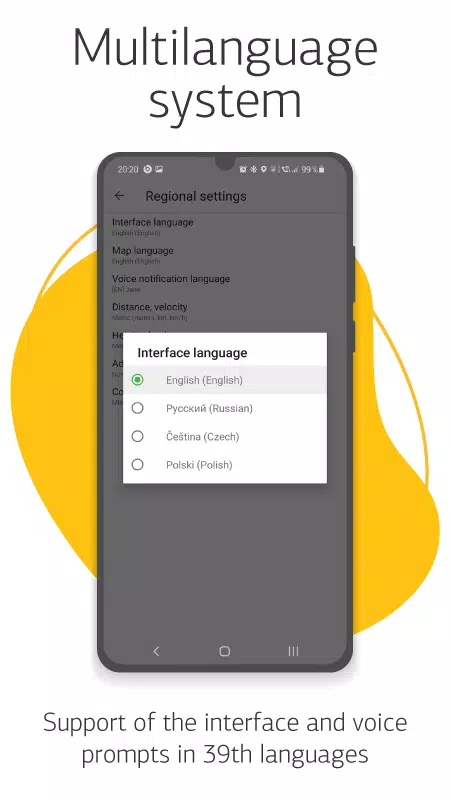
- Multilingual Support: Use the app in your preferred language with interface and voice prompts available in 39 languages.
- Customizable Interface: Tailor the user interface and map display to suit your personal preferences.
- In-App Purchases: Easily buy new map packs or renew existing ones directly from the program menu.
- Multitouch Support: Enjoy quick and intuitive map scaling and rotation with multitouch gestures.
- Dual Navigation Systems: Benefit from the combined precision of both GLONASS and GPS navigation systems.
For any inquiries, reach out to us at [email protected]. Our team is eager to assist you.
Post Comments
Top Download
Top News
-
 2025 Gacha Games: Full Release List
-
 Azure Latch Codes (March 2025)
-
 Black Ops 6 Zombies: How To Configure The Summoning Circle Rings on Citadelle Des Morts
-
 Roblox: SpongeBob Tower Defense Codes (January 2025)
-
 Persona 5: Phantom X Playtest Leaks on SteamDB
-
Chimera Clan Boss Guide: Top Builds, Masteries, and Gear for RAID: Shadow Legends